
Land Surveying Company
Dependable Land Surveys for Development Work
Get a Free Quote From Us Today!
We aim to get back to you in 24 hours.
At Land Surveying Company, we deliver precise land surveying services tailored for land, development, and infrastructure projects throughout the UK. Our skilled surveyors excel in collecting vital site and spatial data, facilitating design, planning, engineering, and construction processes. We employ cutting-edge technology and methods to ensure accuracy, fulfilling all your surveying needs.
Contact us to start your project today.
Who Is Land Surveying Company?
We’re the Land Surveying Company, your go-to experts for comprehensive land surveying solutions. Based in and serving the UK, our aim is to provide high-quality data collection for various sectors, including residential, commercial, and industrial properties.
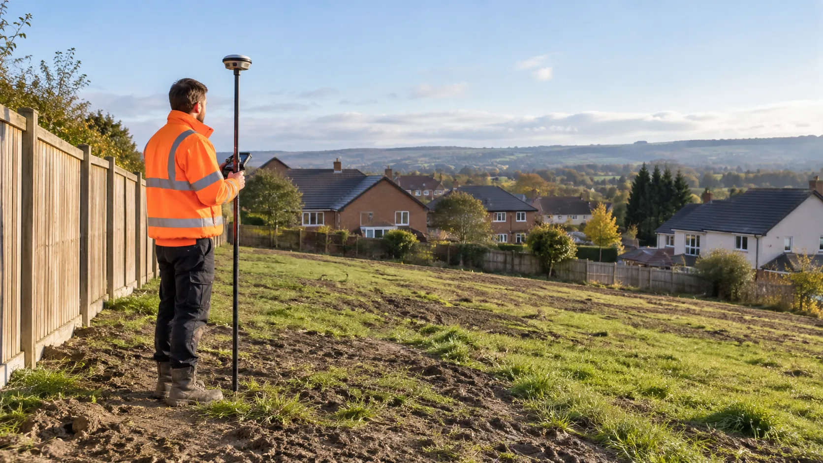
We specialise in topographic surveys, boundary surveys, and construction staking, using advanced equipment like total stations and GPS technology.
In addition to these, we offer geodetic surveys that account for the curvature of the earth, vital for large-scale engineering projects. Our proficiency extends to utility surveys, employing ground-penetrating radar to locate underground utilities such as water pipes and electrical cables.
We adhere to RICS (Royal Institution of Chartered Surveyors) standards to ensure precision and reliability in our projects. Our highly trained surveyors are equipped to handle projects of all sizes, providing detailed reports with CAD (Computer-Aided Design) drawings and 3D models.
Our commitment is to accuracy and excellence, supporting our clients every step of the way. Contact us to discuss your project requirements.
What Services Does the company Land Surveying Company Provide?
At Land Surveying Company, we offer a wide range of surveying services to meet diverse project needs, using precise technologies and methodologies to ensure reliable outcomes.
- Topographic Surveys: We conduct detailed mapping of land features for planning and design, using equipment like total stations and GPS receivers, to provide data crucial for architects and urban planners.
- Boundary Surveys: Accurate property delineation is conducted to resolve disputes and facilitate legal property transactions, adhering to Land Registry standards and guidelines.
- Construction Staking: Our precise marking of structures’ locations ensures accuracy during construction. We typically work from approved architectural plans and are experienced in projects from residential homes to large commercial developments.
- As-Built Surveys: Documenting changes to landscapes or buildings as they are actually constructed, we provide crucial validation for completed construction, adhering to Project Management Institute protocols.
- Geodetic Surveys: Large-scale surveys like these support regional planning and infrastructural projects, using both satellite positioning and terrestrial techniques for mapping precise base lines and elevations.
Contact us to discuss how our services can support your specific project requirements.
When Is Land Surveying Needed?
Land surveying is essential when precise measurements of an area are required. Whether you’re planning a new development, resolving property disputes, or needing accurate data for construction, surveying offers the necessary precision.
It plays a pivotal role during the initial design phases of engineering and architectural projects to ensure all structural elements are accurately positioned, and is also used for verifying that completed structures align with project specifications.
For subdivisions and boundary adjustments, our surveys determine legal boundary lines as per the Land Registration Act 2002, helping prevent potential legal issues. In flood-prone areas, Topographic and Hydrographic Surveys assess elevation and water flow to guide drainage and flood management strategies.
We use Global Navigation Satellite Systems (GNSS) and Total Stations for detailed topographic surveys, ensuring data accuracy for Urban Planning or Environmental Impact Assessment (EIA) studies. These services support a range of clients, from developers and architects to government bodies and private landowners, providing the reliable data necessary for project success.
Get a Free No Obligation Quotation Today
How Does Land Surveying Company Work?
We follow a structured approach to deliver impeccable surveying results, ensuring accuracy and reliability at each stage.
- Consultation and Planning: Understand the requirements and scope of your project. During this phase, we engage with clients ranging from real estate developers to homeowners to identify specific surveying needs. We discuss timelines, budget constraints, and any potential challenges.
- Site Visit and Data Collection: Use advanced tools to gather precise data. Our team employs total stations, GPS systems, and laser scanners to capture detailed topographical information. We adhere to the RICS standards to maintain data integrity and accuracy.
- Analysis and Processing: Transform raw data into usable insights and maps. Our experts use software such as AutoCAD and GIS platforms to process and analyse the data, ensuring all findings align with client specifications and local regulations.
- Reporting and Delivery: Present the information in a clear and actionable format. We compile the results into comprehensive reports featuring detailed diagrams and model visualisations that help clients make informed decisions. Contact us today to schedule your consultation and benefit from our professional surveying services.
Who Does Land Surveying Company Help?
At Land Surveying Company, we assist a wide range of clients, including architects, engineers, developers, and local government bodies. Our services are crucial for residential, commercial, and industrial projects, providing accurate topographic surveys and boundary mapping to facilitate precise planning and design.
We support urban planners in zoning and land-use assessments and work closely with construction managers to ensure every plan and construction meets regulatory standards and client specifications.
We also offer specialised hydrographic surveys for waterfront developments and use drone technology for aerial surveys, which deliver detailed insights that traditional methods may overlook. From small property owners looking to resolve boundary disputes to large construction firms requiring detailed site analysis, we’re equipped to handle projects of all sizes.
Our expertise makes us a valuable partner in achieving precise and reliable results. Reach out to us today to discuss your surveying needs.
How Quickly Can Land Surveying Company Respond?
We understand the importance of timely service and typically respond to enquiries within 24 to 48 hours. Our initial response usually involves a brief consultation to understand your project’s specific requirements.
Based on the complexity of the project, such as topographic surveys or boundary assessments, our scheduling is subject to current demand and project location.
We use advanced surveying equipment, including GPS and robotic total stations, to ensure precision and efficiency. Our team adheres to the RICS standards, which guarantees a high level of accuracy and consistency in our work.
While we aim to conduct surveys as promptly as possible, typically within one to two weeks, larger sites or specialised surveys may require additional time.
Get in touch today to book your survey.
Request a free quote
How Does Land Surveying Company Ensure Quality and Compliance?
Quality and compliance are at our core. We adhere to the Royal Institution of Chartered Surveyors (RICS) guidelines and ensure all surveys meet industry standards and regulations.
Our surveyors are fully trained and continually updated on the latest methodologies and equipment. For instance, we employ the latest GNSS (Global Navigation Satellite System) technology, offering centimetre-level precision for boundary surveys.
We also conduct topographic surveys using Total Stations and 3D laser scanning to capture detailed site data. Our processes include regular calibration of equipment to align with ISO 9001 quality management standards.
By implementing these practices, we strive to deliver accurate, reliable results every time. Our commitment extends to conducting thorough risk assessments to identify potential compliance issues, ensuring smooth project execution.
We invite you to discuss your surveying needs with our expert team.
Why Choose Land Surveying Company?
Select Land Surveying Company for your surveying needs and enjoy reliable services grounded in expertise and precision. Our team has developed a long-standing reputation in both residential and commercial sectors, providing property developers and homeowners with accurate and insightful surveys.
- Expertise: Years of experience in the UK surveying industry enable us to tackle projects of varying complexity, from small plots to large, multifaceted developments.
- Accuracy: We use the latest technology, such as GPS-based total stations and 3D laser scanners, to ensure precise data collection that supports construction, renovation, and infrastructure projects.
- Comprehensive Services: Our full range of surveying solutions includes topographical surveys, boundary demarcations, and as-built surveys tailored to specific project requirements.
- Customer Focused: We are committed to understanding and fulfilling your unique needs, offering consultations and reporting that clarify complex data for informed decision-making.
- Regulatory Compliance: All work is meticulously completed in accordance with RICS standards, ensuring consistency and quality across the board.
Whether you are planning a new development or looking to resolve boundary disputes, our commitment to professionalism and quality sets us apart. Contact us to discuss your project requirements today.
Frequently Asked Questions
What is a topographic survey?
A topographic survey provides detailed information about the land’s surface features, including elevations and contours, which architects and engineers use for planning and design.
How long does a boundary survey take?
The duration of a boundary survey depends on the property size and complexity, typically taking from a few days to a week to complete and reporting the results.
Can surveys be used in legal disputes?
Yes, surveys are critical in resolving legal property disputes, as they provide accurate boundary and land measurement data that can support legal proceedings.
Get a Free Quote
Ready to start your surveying project? Contact Land Surveying Company for professional insights and precise data.
speak with our team today
What People are Saying About Us
★★★★★
“Land Surveying Company gave us a clear set of drawings with all the levels marked. Would definitely use them again for another site.”
Fiona Lockwood
London
★★★★★
“Land Surveying Company were so much more helpful than I had expected, a really friendly and approachable team.”
Kieran Davies
London
★★★★★
“Delighted with our site survey from Land Surveying Company. Would recommend them to anyone with land to survey.”
Harvey Kaur
London
★★★★★
“The survey from Land Surveying Company gave our planning consultant everything needed for the application, with no further visits. A well-managed job I would recommend.”
Thomas Barker
London
Our Locations
We are proud to work nationally across the UK, allowing us to ensure we can provide services to you.
For a full list of counties we cover in the UK, see below.